Operational Planning with LiDAR
The Advantage
Harnessing an Industry Game Changer
The technology tools available today to support operational planning have changed the way we do business. Detailed point cloud information from LiDAR data allows you to stand in the forest while working at your desk.
Forsite has both the operational forestry knowledge and the technology skills to ensure our clients realize maximum value from LiDAR based operational planning work. The planner’s ability to review highly detailed data in the office greatly reduces the need for recce, and the ease at which alternatives can be assessed ensures that the best possible plan is implemented – considering cost, safety, and environmental issues. Using LiDAR planning tools you can expect to save 25-35% of your layout costs.
We can calculate individual tree volumes and species identification in combination with terrain tools to design roads, stream crossings, locate cutblock boundaries based on timber values and engineering constraints and account for stream and riparian locations with a high degree of confidence and accuracy.
Here are the tools we use to harness your LiDAR.
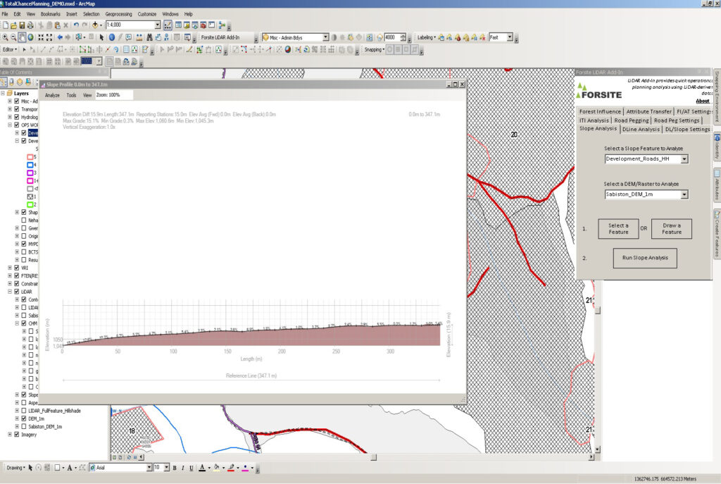
ROADENG
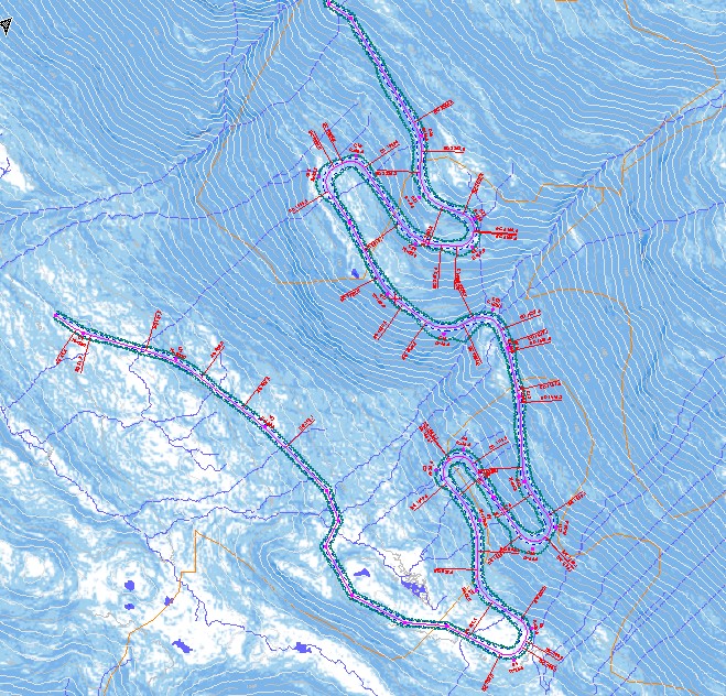
Road construction is one of the biggest cost items with respect to cut block development, and even more so in steep terrain, where the use of LiDAR shines brightest. With RoadEng, we can create a very detailed, site specific estimation of where exactly a road is best located and a close approximation of how much it could cost to build.
ARCMAP
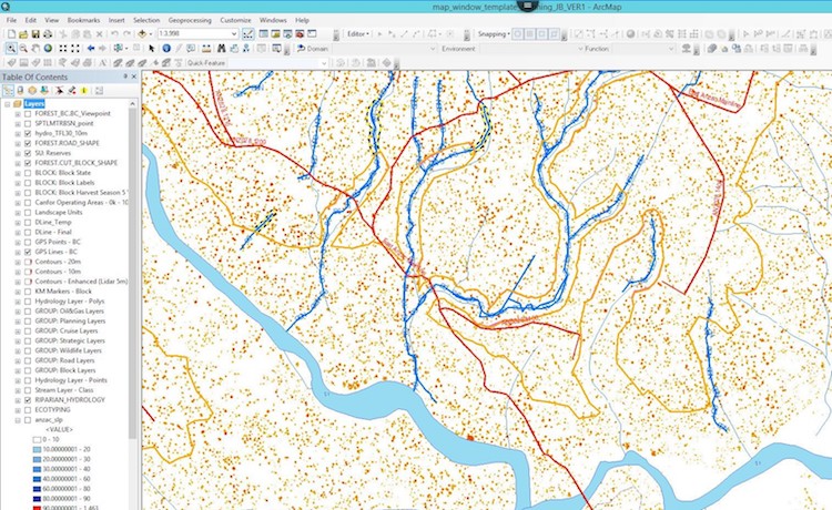
With the use of LiDAR derivatives, such as canopy height models or slope, and the spatial power of ArcMap, we can easily design total chance plans that include overarching, landscape level constraints all the way down to site specific concerns such as inoperable terrain, or areas where timber height indicate immature or undesirable volume. Visit here to learn more about Forsite’s custom ArcMap Add-In Tools.
Advantage of LiDAR ArcMap Add-In Tools
Leveraging LiDAR data and derivative products (e.g. slope themes, 1m contours, Digital Elevation Models, Canopy Height Models, etc.) enables our planners to understand the terrain and drainage patterns in an area of interest before a site visit occurs, allowing them to create operationally realistic road locations and block boundaries that can then be field checked.
Capabilities of the LiDAR Tool range from defection line and slope analysis to identifying potential fish barrier features as well as areas that require specific harvest systems (conventional, steep slope, winch assist, cable yarding).
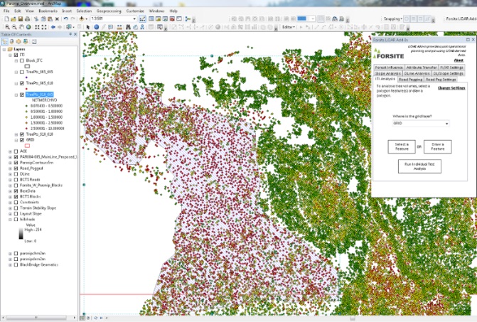
One of the main features of the LiDAR Tool is the ability to leverage another product called Individual Tree Inventory (ITI). By delineating individual stems on the land base, we can then create a polygon around an area of interest and at a click of a button, produce an output that shows a variety of timber attributes.
Contact Us

Jamie Black, RPF
Forestry Supervisor & LiDAR Operational Planning Lead
Tel: 778-256-3097
Projects
CANADIAN FOREST PRODUCTS LTD. – PRINCE GEORGE
2018 to present
To augment Canfor’s planning with LiDAR based derivatives, Forsite provided expertise with landscape level planning (patch size, wildlife corridor, etc.) and ensuring operationally feasible blocks through the use of software tools such as ArcMap and RoadEng.