Forest Inventory Services
We combine the power of foresters, data (LiDAR/spectral) and machine learning. We use Forsite’s forestry knowledge and expertise to produce forest inventory products relevant to your needs, data and budget. Whether you need detailed information on individual trees or the attributes and characteristics of forest stands, Forsite’s forestry experts will work with you to understand your needs and recommend a technology solution that best meets those needs.
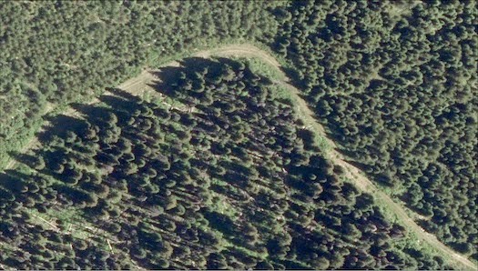
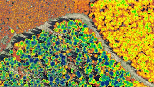
Using the power of LiDAR data, we can identify individual tree locations and attributes including species, height, diameter, and log products. Tree level data is a powerful tool for operational forest managers who need to plan harvest areas, identify forest products, model fire risk, understand forest health and predict fiber supply.
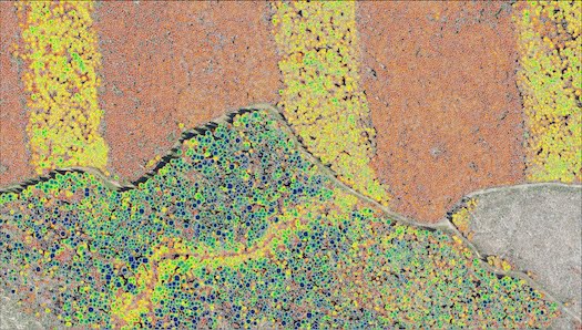
Using LiDAR, imagery, and ground plots to describe forest stands over large landscapes result in detailed, cost-effective inventories with known error estimates.
EXPLORE OUR INTERACTIVE ENHANCED INVENTORIES PAGE →
At Forsite, we’re bridging the worlds of traditional and innovative inventories. We’re forest management specialists and bring our deep understanding of operational and strategic forest management to the process. We have multiple approaches to tackle forest inventories with innovative technology – with the aim of matching the end product with client needs. Whether you want to identify individual trees with log products by species, or you’re interested in more generalized biomass/carbon inventories, we can help you figure out which approach is right for your needs and create customized solutions.


Our breadth of forestry skills and knowledge combined with our technological capability allow us to offer a full suite of inventory products, and the ability to link operational and strategic inventories.
- Standard Enhanced Forest Inventory (20x20m rasters)
- Satellite Derived Species (20x20m rasters)
- Individual Tree Inventories with Log Products by Species
- Government accepted Polygon Inventories (built by aggregating Enhanced Forest Inventory / Individual Tree Inventory data)
The Forsite team has analyzed over 4 million hectares of forested territory, producing statically defensible volumes for timber supply modeling.
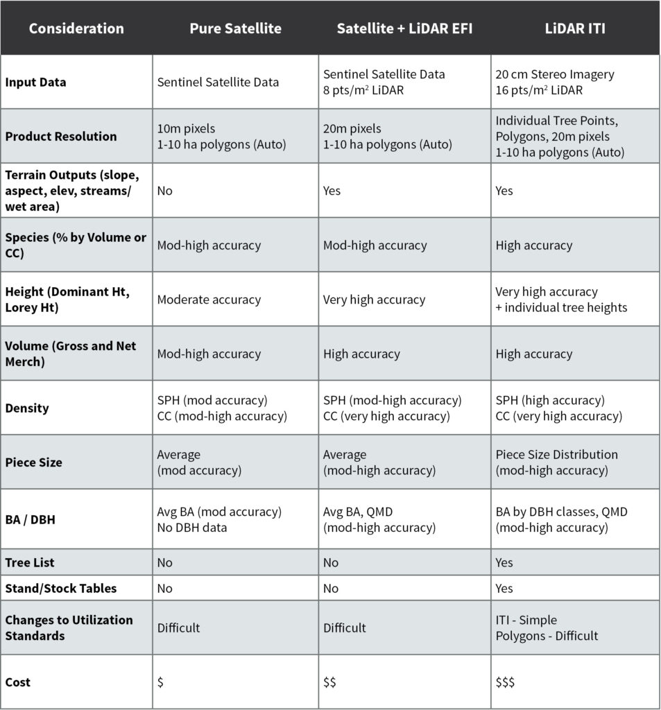
The following table summarizes the key highlights of various remote sensing methods by Forsite commonly uses to produce forest inventories. These options allow clients to find the right tradeoff between accuracy and value:
Value detailed innovative forest inventories provide:
- Better informed risk management decisions (terrain, water, visuals, habitat, etc.)
- Enhanced timber value extraction
- Cost savings during timber development planning
- Multiple scales of inventory
- Detailed tree and log data
- Reliable log supply and cashflow forecasting
Individual Tree Inventory
Forsite provides world-leading and cost effective forest inventory services to clients across Canada and the United States. Using the power of LiDAR data and Forsite’s TreeID technology, we can identify individual tree locations and species and model the shape and size of each tree. Attributes include:
- Diameter
- Species
- Height
- Product
Area Based Inventory
Forsite’s ForestID technology and the use of LiDAR, imagery, and ground plots describe forest stands over large landscapes. Attributes include:
- Basal Area
- Tree List (size and height)
- Stand Density
- Total/Merchantable/Product Volumes
- Species Composition
Polygon Inventory
Government accepted Polygon Inventories built by aggregating Enhanced Forest Inventory / Individual Tree Inventory data. Attributes include:
- Basal Area
- Tree List (size and height)
- Stand Density
- Total/Merchantable/Product Volumes
- Species Composition
EXPLORE OUR INTERACTIVE ENHANCED INVENTORIES PAGE →
Utilities Vegetation Risk Assessments
Leveraging LiDAR, satellite data, and our proprietary machine learning technology, Forsite is uniquely positioned to help clients use individual tree metrics to understand the composition, health, and geolocation of their vegetation asset base. Forsite has years of experience creating millions of acres of vegetation inventories. These analyses catalog green assets in order to plan vegetation maintenance based on risk & hazard and provide the foundation for projecting growth by species into the future; highlighting “fast-growers” that will become issues in subsequent maintenance cycles and allowing clients to proactively plan mitigation efforts.
Get in Touch

Mike Parlow
INVENTORIES TEAM LEAD
Tel: 250-954-7850

Maurice LeBlanc, RPF
SOLUTION DESIGN SPECIALIST
Tel: 506-461-4900

Cam Brown, RPF
STRATEGIC PLANNING FORESTER
Tel: 250-832-3366 (Ext 2220)